
Raritan Township ZIP Code Labels
Postal delivery and township jurisdiction use different boundaries. Research located four postal labels that may intersect Raritan Township, but the source is non-governmental and does not establish a complete official coverage list. Treat each row as a provisional address-by-address label to verify with USPS and with the Township parcel records. In particular, a Flemington mailing address does not show that the parcel lies in Flemington Borough. The same caution applies to Ringoes, Stockton, and Pittstown labels that can cross municipal lines.
| ZIP | Areas Covered | Post Office | Notes |
|---|---|---|---|
| 08551 | Possible eastern and southern Township addresses | Ringoes postal label | Provisional intersection. Verify each address; postal city is not a Township boundary. |
| 08559 | Possible western and southwestern edge addresses | Stockton postal label | Provisional intersection. Verify address by address before using it for a Township search. |
| 08822 | Possible central addresses and the municipal-complex mailing area | Flemington postal label | Provisional intersection. The label can cover Township parcels outside Flemington Borough. |
| 08867 | Possible northern and northeastern Township addresses | Pittstown postal label | Provisional intersection. ZIP boundaries can cross municipal lines. |
No official source reviewed here confirms that these are every ZIP code used in Raritan Township. Use a postal result as an address label, then check the tax-map municipality, block, and lot before relying on it for a local record search.
Note: The four rows identify research leads, not an authoritative Township-wide ZIP coverage list.
Four Raritan Township ZIP Checks
The key local pattern is not a separate ZIP district for each neighborhood. Raritan Township is a broad Hunterdon County township centered near Flemington, with both newer address clusters and older rural parcel geography. Ringoes, Stockton, Flemington, and Pittstown are postal designations that may appear on mail for Township parcels. A postal city is therefore a search aid, not a substitute for the municipal name carried on an assessment map or deed.
Use the ZIP only to normalize the address at the start. When results point to a parcel, retain the Township name and the block-and-lot identifier. That is especially important when a record uses an old road, a farm name, an adjoining owner, or a legal description instead of the current postal address.
USPS Modes for Raritan Township ZIPs
The USPS ZIP Code Lookup supplies three distinct checks. By Address accepts a street address, city, state, and ZIP, with a company field available. By City and State looks up a postal place from those two fields. Cities by ZIP starts with the ZIP itself. For a Raritan Township address, the first mode is the strongest way to confirm the form that the Postal Service recognizes before comparing the result to county and Township records.
- ZIP code
- A postal routing code used for delivery. It is not a municipal-boundary record.
- ZIP+4
- The extra four digits refine delivery sorting for part of a route, building, or group of addresses.
- PO Box ZIP
- A ZIP assigned for post-office boxes. It does not describe all street addresses in a locality.
- Unique ZIP
- A ZIP used for one organization or delivery arrangement. No verified example was located for Raritan Township.
- Carrier route
- A delivery sequence used by the Postal Service, not a local-government district or proof of residence.
USPS also warns that a ZIP lookup does not confirm that a person or company is at the address. It confirms postal addressing only. Do not treat the result as evidence of who occupies a parcel.
Raritan Township ZIP Search Gaps
None of the local public tools reviewed has a documented ZIP filter. The Township’s SDL portal accepts full or partial address, owner name, block and lot, permit number, or control number after a free account is created. Its public description does not document ZIP-wide filtering. Hunterdon County GIS is address based, and its help material describes an address search, a selected result, a parcel click, and layer attributes, not a ZIP query. The New Jersey Property Explorer is map and parcel based, without a documented ZIP control.
That gap changes the honest search method. Do not infer a Township-wide list from the Flemington, Ringoes, Stockton, or Pittstown postal labels. First verify actual postal addresses through USPS. Then use SDL, the tax list, or the GIS viewer one parcel at a time. A parcel export may be useful only when an office itself provides it with clear scope.
The route also varies by the question. SDL is the Township property and permit route, with a free account required for participation. The state explorer supplies the January annual tax-list snapshot. County GIS places an address on the map and lets a user click a parcel for available layer attributes. For a specific Township record that does not appear through those routes, OPRA is a request path for an identified record, not a request for the Clerk to assemble an open-ended ZIP list.
Raritan Township ZIP Parcel Fields
After a USPS check, the New Jersey Property Explorer can provide the annual tax-list view behind a Raritan Township ZIP code. It is a map query, not a resident roster and not a live transfer index. Its documented result fields identify the parcel location, owner information, block, lot, annual land and building assessed values, prior-year taxes, and property classification. The state says its data is submitted in January, so a later ownership transfer can lag in the display.
| Property Explorer field | Type | What the documented result supplies |
|---|---|---|
| Property or address location | Map/search | Parcel location selected through the map query. |
| Owner information | Result field | Tax-list owner information, not proof of current occupancy. |
| Block and lot | Result attributes | New Jersey tax-map identifiers for matching a parcel. |
| Assessment, taxes, classification | Result fields | Annual land and building values, prior-year taxes, and the stated class. |
The Property Explorer landing page is shown below. Its annual view is a useful cross-check after the postal address and Township parcel have been matched.
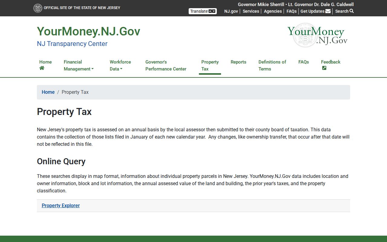
Use the block and lot from this tax-list view to keep the Raritan Township ZIP code search tied to the same parcel across map and deed records.
Residents Within a Raritan Township ZIP
A ZIP code directory can support a cautious parcel workflow, even though the documented local portals do not offer a ZIP filter. Begin with one known address. The object is to establish the postal label and municipal parcel identity, not to make a claim about every person in a ZIP area. Once an address is confirmed as a Raritan Township parcel, the record trail can move from the map to owner, deed, permit, or tax information.
- Enter the complete address in the USPS lookup and save the normalized postal city, state, and ZIP result.
- Search the address in the Township SDL route or the County GIS viewer, then confirm that the parcel is in Raritan Township.
- Record the block and lot from the parcel or annual Property Explorer result, keeping the postal label separate from the municipal identity.
- Use the County Clerk for a deed question, or the appropriate Township office for an identified parcel or permit record.
When the ZIP has narrowed the address to a road, the Raritan Township street directory uses the more detailed by-address record chain.
Raritan Township Postal Limits
Flemington, Ringoes, Stockton, and Pittstown labels do not draw the Raritan Township line. A postal service needs delivery geography; a tax map and deed need a parcel identity. These systems can overlap without agreeing at the edge. The Township’s own research materials make the local distinction clear: use USPS to normalize mail, then use SDL, GIS, tax maps, and the County Clerk to determine the parcel’s legal and municipal record.
Old-record work needs an even stricter separation. The documented local research did not establish a street-renumbering year, a ZIP realignment, or a complete historical postal boundary. Avoid filling those gaps with assumptions. Compare the deed legal description, the block and lot, and adjoining owners when a modern mailing label does not fit an older record.
Ownership information has its own limit. The annual tax-list display can identify an owner and property location, but its public description does not establish a mailing-address field, an occupancy field, or a live transfer history. Keep owner, physical parcel, and postal address in separate notes. Combining those fields can turn a useful Raritan Township ZIP code check into an unsupported claim.
Note: A postal-city result is not proof that an address falls inside Flemington Borough or another named municipality.
Raritan Township ZIP Map Continuity
Raritan Township Engineering maintains the Township Street Map and official tax assessment maps. It also reviews metes-and-bounds descriptions, easements, and rights-of-way before County Clerk recording. Those records provide the bridge when a road, subdivision, or parcel changes but the postal label stays familiar. The Hunterdon County GIS address autocomplete can test a current address, while the Township maps and recorded plats help resolve a parcel history.
For older rural locations, search the legal description, farm name, and adjoining owners rather than assuming that a current ZIP code or postal city appeared in the historic record. No verified Raritan Township Sanborn coverage or official renumbering event was found in the research, so neither should be assumed.
Use each office for the record it keeps. GIS can connect a typed address to parcel geometry and available map layers. Engineering can clarify a road, easement, right-of-way, or assessment-map relationship. The County Clerk supplies recorded land instruments. This division of work is why a postal lookup belongs at the beginning of a Raritan Township ZIP code check, rather than at the end of the property decision.